
Drone Videography: When Aerial Footage Is Worth Using
A drone can make an ordinary location look impressive for a few seconds.
That does not automatically make it useful.
The best aerial footage does something a ground camera cannot do as clearly. It might reveal the scale of a site, show how several buildings relate to each other, follow a route through a landscape or place an operation in its wider surroundings.
That is when the height has a job.
At The Camera Guys, drone filming and aerial photography can be used as a standalone service or built into a wider production. The question we would rather answer before take-off is not simply can we get a drone shot?
It is:
What will the viewer understand because we did?
The useful aerial shot is usually explaining something
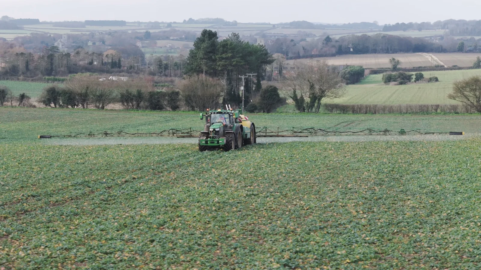
Picture a tractor moving across a large field.
At ground level, you can show the machinery, the crop, the driver and the detail of the work. Those shots bring the viewer close to the operation.
Move into the air and the information changes.
Now you can see the size of the field, how the machinery moves through it and where that one action sits within a much larger landscape.
Neither viewpoint is inherently better. They answer different questions.
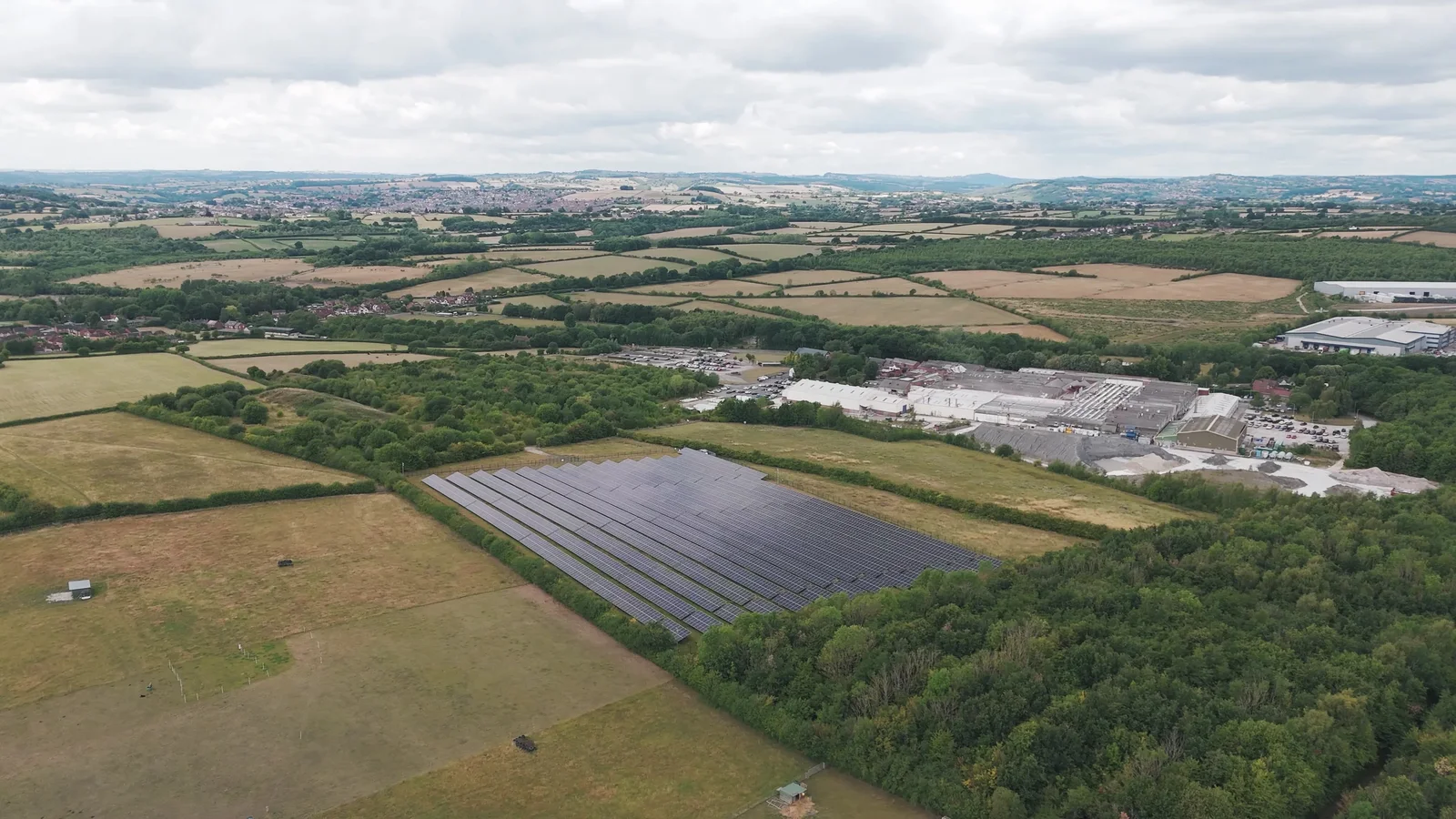
That distinction is why aerial footage worked naturally in our Sentry agricultural film project. We filmed across multiple working farms in Norfolk, combining close ground-level coverage of machinery and processes with aerial views of the land. The drone was not there simply to make the films look more expensive; it helped connect individual operations to the scale of the environment around them.
That is a useful test for almost any brief:
If we removed the aerial shot, what piece of information would disappear?
If the answer is “nothing, but it looks nice”, the drone may still have some visual value. It just should not automatically become a major part of the production.
Four situations where height can genuinely improve the story
There are countless possible drone shots, but most of the useful ones fall into a few broad jobs.
1. Showing scale
Some subjects are difficult to understand from eye level.
A construction site, farm, estate, industrial development, venue or large outdoor attraction can feel fragmented when every shot is taken from the ground. An aerial view can establish the whole before the film moves into the detail.
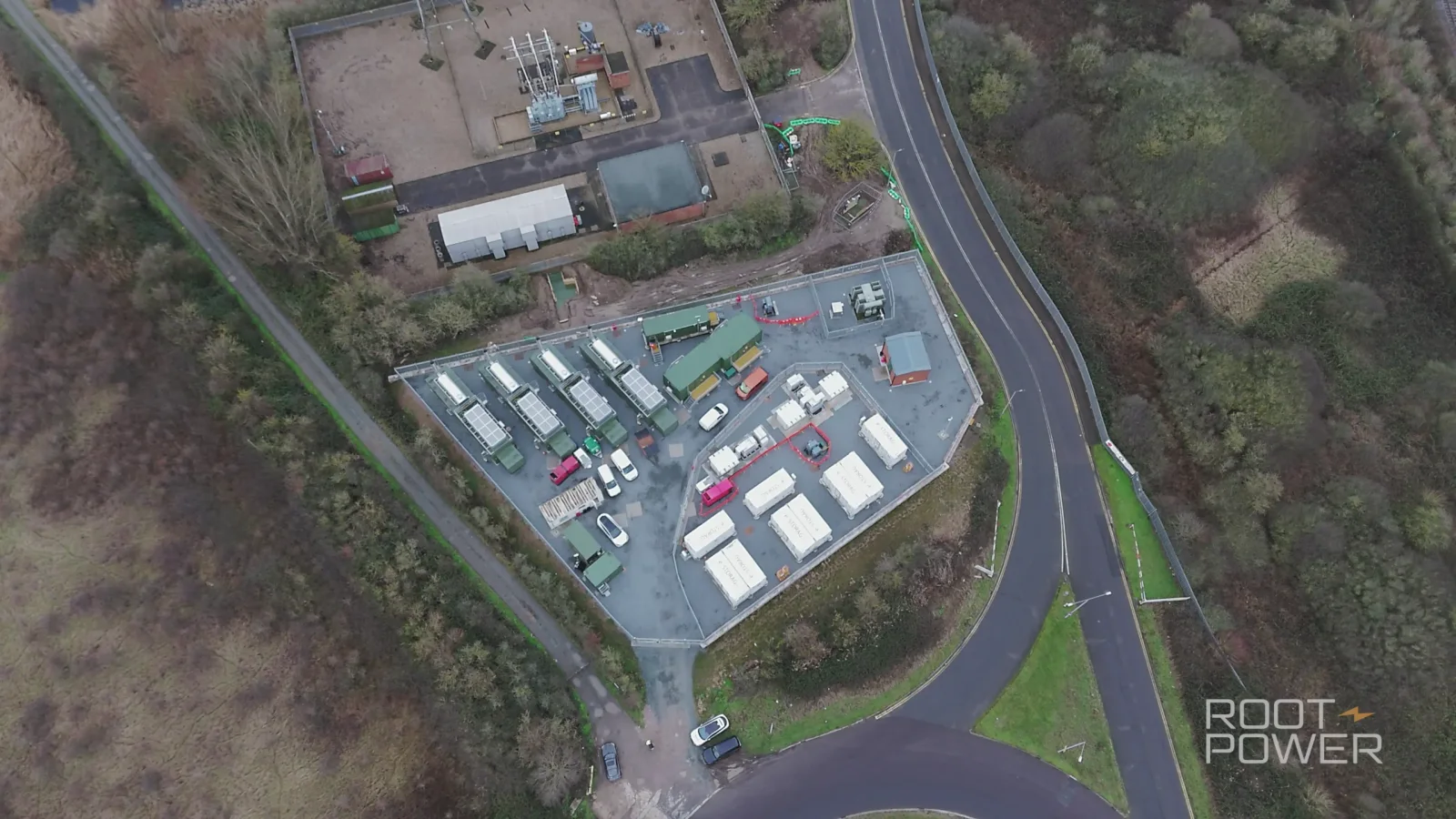
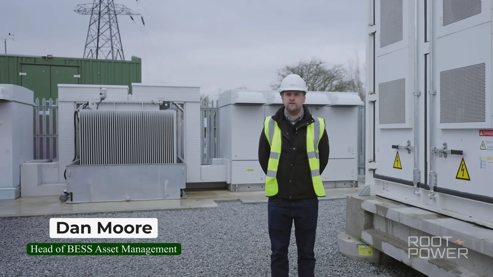
For Root-Power's Coryton BESS project, we returned to the same Essex energy development at different stages and combined interviews, detailed ground filming and drone coverage. From the ground, the viewer could see the infrastructure and work close up. From the air, the wider scale and layout of the site became much easier to read.
That combination is particularly useful for corporate video production where a business has a real physical operation to explain.
2. Showing where things are in relation to each other
Aerial footage can also be useful when geography matters more than sheer size.
A property may sit within substantial grounds. A visitor attraction may have several areas spread across a site. A business campus may contain multiple buildings. A route might connect one location to another.
In those situations, an overhead or elevated view can answer a question that would otherwise need a map, graphic or several separate ground shots.
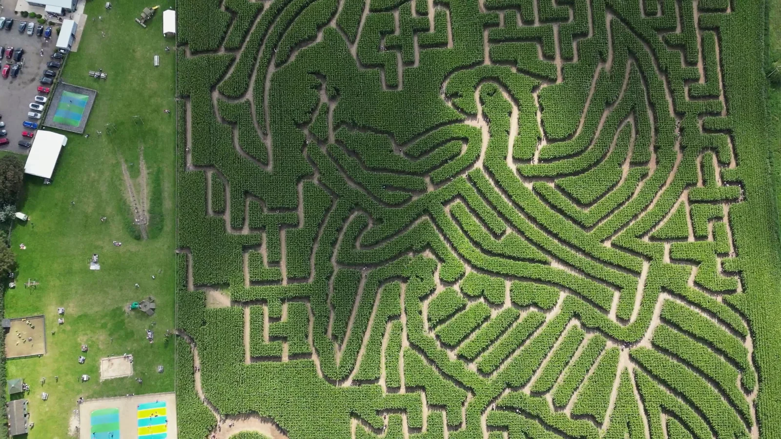
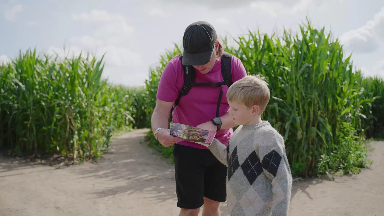
Our Southwold Maize Maze project is a good example. The aerial footage could reveal the design of the maze, its scale and its rural setting in a way that a camera inside the attraction simply could not.
The ground footage then did the other half of the job: people, activities, reactions and detail.
3. Showing progress over time
For construction, infrastructure and long-term site work, the same aerial viewpoint can become useful for another reason: comparison.
Returning at different stages can provide a visual record of how a location changes. That does not mean every progress shoot has to become a cinematic film. Sometimes the most useful result is straightforward, repeatable coverage that makes development easy to see.
If the project also needs interviews, ground footage or a finished project film, aerial coverage can be planned as part of the same visit rather than treated as a separate spectacle.
Our aerial services include visual progress and inspection imagery where the proposed flight is suitable. For specialist survey conclusions, measured mapping, thermal analysis or engineering assessment, the appropriate specialist service should be commissioned rather than assuming ordinary drone imagery provides those answers.
4. Showing the setting around a property
A property can look completely different when the viewer understands what surrounds it.
Ground-level photography and video are better for rooms, finishes, details and the way it feels to move through the building. An aerial view can add the grounds, access, neighbouring landscape and overall position.
That is why our property photography and videography work can include drone coverage where the location and conditions allow.
Again, the aerial view is not replacing the normal property film. It is supplying context the interior camera cannot.
When a drone is probably not the answer
There is a temptation to treat drone footage as a production-value button: add aerial shot, make film more cinematic.
Sometimes it does exactly the opposite.
When the story is really about people
If the important part of the film is a conversation, an expression, a craft process or a small human interaction, moving the camera 80 metres away can create distance at precisely the wrong moment.
A people-led brand film may benefit from one establishing aerial at the start. It may need none at all.
Do not interrupt a strong human story every thirty seconds simply because drone footage exists.
When the location is not interesting or informative from above
Some buildings, industrial units and urban locations are much stronger from ground level.
A drone does not magically reveal a compelling composition. Sometimes it reveals a roof, a car park and several neighbouring buildings that the client would rather not make central to the film.
The only way to decide is to think about the actual site, not an imaginary generic drone shot.
When the final video is extremely short
If you are making a 10-second social edit, every shot has to work hard.
A long aerial reveal might consume half the finished video before the viewer has even seen the product, person or event.
There are exceptions, but the drone should earn those seconds.
When flying introduces more compromise than value
Airspace, nearby people, the proposed take-off area, the aircraft being used, privacy, the site itself and current restrictions can all affect what is practical.
Weather can change that again on the day.
A useful production does not become a failure simply because the aircraft stays on the ground. If the film only works when one particular aerial shot happens, the brief needs a stronger fallback.
Do not write “drone shots” into the brief. Write what they need to show.
This small change makes a big difference.
“Get some drone footage of the venue” leaves almost every creative decision until the day.
“Show the venue in relation to the river and main access road” gives the aerial sequence a purpose.
Likewise:
Weak:
Get a cinematic shot of the site.
Better:
Reveal the full construction footprint before cutting into the ground-level machinery.
Weak:
Follow the vehicle with the drone.
Better:
Show the route from the entrance to the working area so viewers understand how the two locations connect.
That level of thinking also helps us decide whether a drone is even the best tool.
Sometimes an elevated building position, long lens, gimbal move, map, animation or carefully chosen ground-level wide shot communicates the same information more clearly.
When you are scoping the wider production, our guide to writing a video production brief is a better starting point than prescribing equipment before the communication problem is clear.
One strong aerial sequence is better than five interchangeable ones
Drone cameras make movement relatively easy.
That is not an invitation to use every possible movement in the finished film.
Orbits, rises, reveals, tracking shots and top-down views all have their place, but a sequence becomes repetitive quickly if every aerial shot exists simply because the aircraft could perform it.
For each planned shot, think about:
- what the subject is;
- what new information appears as the shot develops;
- where the movement begins and ends;
- whether it connects naturally with a ground shot;
- how long the editor is realistically likely to use it;
- whether people, traffic or visible branding change the frame;
- whether the light will match the rest of the sequence.
A slow reveal over a building might be perfect.
A top-down shot of machinery may explain a process beautifully.
A tracking move across a field may establish scale and motion at once.
You do not necessarily need all three.
The aerial and ground cameras should feel like one production
Some films have an obvious visual break whenever the drone appears.
The colour changes. The frame rate changes. The light no longer matches. Every ground shot feels intimate, then the film suddenly cuts to an unrelated aerial panorama.
That can be avoided during planning.
If aerial coverage is part of a wider shoot, think about how the editor will enter and leave each sequence. A person or vehicle travelling in the same direction can create a visual connection. A wider ground shot can establish the location before the aerial expands it. Matching the time of day can make the transition feel natural.
Resolution, frame rate, exposure and colour also matter. Aerial footage does not automatically match the main cameras simply because both record high-resolution video.
This is one reason it can be useful to plan video production and drone filming as one job rather than collecting disconnected shots and hoping they fit later.
Weather is not an inconvenience to argue with
Outdoor productions are always affected by conditions, but aircraft add another layer to the decision.
Wind, rain, visibility, temperature and changing light can all affect whether a planned flight is suitable. Conditions at ground level do not necessarily describe what is happening higher up or in a more exposed part of the site.
The important thing for a client is simple:
the final call on whether it is safe and lawful to fly belongs with the operator and remote pilot, not with the pressure of the production schedule.
A good plan assumes that possibility before the crew arrives.
That might mean having a ground sequence that performs the same storytelling job, knowing which parts of the shoot can continue while conditions change or deciding in advance when a return visit would actually be worthwhile.
Commercial drone filming in the UK needs proper planning
For paid commercial drone work in the UK, the flight needs to be considered under the current Civil Aviation Authority framework.
The exact requirements depend on factors including the aircraft, the type of operation, the people and property around it and where the flight will take place. Some work can be completed within the Open Category; more complex operations may require additional competency and an applicable CAA authorisation.
Commercial drone operations also require appropriate third-party liability insurance.
For clients, that means aerial footage should never be treated as “someone will bring a drone and see what happens”.
Before a proposed flight, we assess the location, access, airspace, people, property, aircraft, weather and the actual shots the production needs. Landowner, venue or airspace permissions can also be relevant depending on the location.
The rules change over time, so current CAA guidance should be checked for each production rather than relying on something remembered from a previous shoot.
Drone footage can be useful without dominating the film
Some of the strongest uses of aerial footage are brief.
Five seconds can establish an entire site.
One reveal can connect a building to its landscape.
A short overhead movement can make the layout of an attraction immediately obvious.
Then the film can return to the people, products, machinery, rooms or details that actually carry the story.
That is usually a better way to think about drone videography than asking whether a production “should have drone shots”.
Ask what the viewer needs to understand.
If height is the clearest way to show it, use the height.
If it is not, keep the aircraft on the ground.
If you are planning a commercial film, property shoot, construction update or multi-location production and want to know whether aerial footage would genuinely add anything, explore our drone filming and aerial photography services, see more recent projects or send us the location and brief. We can assess whether drone coverage makes sense before it is built into the production.